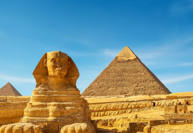
Ancient Egypt Geography
Ancient Egypt geography is one of the factors that shaped Egyptian civilization, based on natural resources from the eternal Nile River and the resulting emergence of villages and cities. Also, the widespread deserts provided a natural environment to protect the country, in addition to the presence of the Red Sea and the Mediterranean Sea as corridors for commercial and cultural exchange. Geography is considered an influential factor in political, economic, and also religious aspects.

Ancient-Egypt-Geography
Ancient Egypt geography played an effective and essential role in the development of the Pharaonic civilization, which was represented in the following:
- Commercial prosperity which resulted from Egypt’s distinguished geographical location between the world’s continents.
- The presence of natural forts, which were formed by the desert, spread on the eastern and western sides.
- The emergence and development of civilizations, for example, the Nile River which was the main reason for the prosperity of agriculture and the emergence of many villages and cities on its sides.
- Commercial openness and the increase in trade exchange rates as a result of the presence of the Red and Mediterranean Seas.
The Nile River and the Emergence of Ancient Egypt
The Nile River is one of the main axes in the formation and emergence of ancient Egypt, as follows:
- The most prominent source of life, as the ancient Egyptians relied on it for agriculture and water. It also helped in the growth of crops because of the silt it leaves after the flood.
- An important food source as it contains fish, and many birds also live on its banks, which enhanced food diversity.
- The effective contribution to the development of internal trade, as it was used as a means of communication and transport for goods as well as travelers.
- The Nile River was associated, according to ancient Egyptian beliefs, with the symbol of life and fertility, as it was linked to many religious rituals.
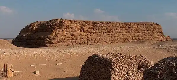
The Eastern and Western Deserts in Ancient Egypt

The-Eastern-And-Western-Deserts-In-Ancient-Egypt
The deserts surrounding Egypt represented one of the features of Ancient Egypt geography, and the most important factors of natural protection that performed the following functions:
- Civilizational Stability: The deserts provided natural shields for protection from external invasions. The Eastern Desert also connected the Red Sea with many roads, which contributed to economic stability and enhanced trade.
- An important source of minerals and limestone: The deserts contain a group of minerals, most notably copper and precious stones, which were used in various Egyptian industries, which strengthened the industrial side. Granite and limestone were also extracted from the Eastern Desert to build temples.
- Sacred areas and a home for wildlife: The Egyptian desert contains many wild animals that were used for commercial or hunting purposes, in addition to the presence of oases that made them public sacred centers according to ancient Egyptian beliefs.
The Division of Egypt into the Black Land and the Red Land
The Egyptians divided Ancient Egypt geography into both the Black Land and the Red Land as follows:
The Red Land
It was called “Deshret” according to ancient Egyptian beliefs and was represented by the desert surrounding the Nile Valley. It was known as the Red Land due to its dry soil that is devoid of agriculture. It represented for them the place full of evil spirits and the world of death and danger. Despite that, it is a source of precious stones and minerals.
The Black Land
It was known as “Kemet” according to the myths and was represented by the fertile lands on both sides of the Nile. It was known for its blackness due to the silt it contained, resulting from the annual flood of the Nile. It expressed growth and fertility. It includes the centers of villages, agriculture, and sites for cities. The ancient Egyptians looked at it as the gift of the Nile god, Hapi.
And here, the Egyptian thought emerged, as they saw that the balance between life and death, represented by the Black Land and the Red Land, is one of the factors for the continuation of the universe. Their understanding and vision of the world around them depended on the compatibility and harmony between opposing forces of good and evil, death and life.
Natural Resources in Ancient Egypt

Natural-Resources-In-Ancient-Egypt
Natural resources in ancient Egypt were numerous and included many resources, foremost among them the Nile River, the artery of life, and the agricultural lands, which were considered among the most fertile lands in the world. This is in addition to the presence of plants that were used in natural remedies and wood for making ships and other supplies.
And let us not forget the animal wealth and its diversity of goats, birds, and animals, on which they relied as a source of food and for performing religious rituals. This is in addition to the natural resources of the sun’s heat, which was exploited by drying crops, and the winds for moving boats. Here, the impact of Ancient Egypt geography on its natural resources becomes clear.
How did the geographical location of Egypt affect its commercial and cultural relations?
Ancient Egypt geography had a strong impact on its commercial relations with other countries, in addition to the noticeable cultural influence. We clarify this as follows:
Commercial Relations
Egypt’s distinguished location, which is in the middle of the meeting point of the continents of Asia, Africa, and Europe, as it is bordered by both the Red and Mediterranean Seas, which makes it an active center for commercial exchange by facilitating the movement of transport and the presence of seaports. It also contributed greatly to revitalizing commercial relations and trade exchange between countries.
Cultural Relations
The cultural exchange between countries was a result of Egypt’s location overlooking both seas and the desert outlets, which facilitated movement and exchange between countries. Here, Egypt transferred its civilization to other countries and was influenced by some foreign customs, which contributed to the existence of a diverse artistic culture that extended over the ages.
Irrigation and Agriculture Systems in Ancient Egypt
The irrigation and agriculture systems, as one of the main axes shaped by Ancient Egypt geography, took on specific features and characteristics, which came as follows:
- Total reliance on the waters of the Nile River for irrigating the lands.
- Agriculture in the areas surrounding the river, which is characterized by the presence of fertile silt resulting from the annual flood of the Nile.
- Subjection to an administrative system that organizes the dates of irrigation and agriculture as one of the foundations for the establishment of the Pharaonic state.
- Building canals and channels aimed at organizing the distribution of water appropriately. The shaduf was used for the purpose of lifting the Nile’s water to high lands.
Conclusion
Ancient Egypt geography shaped its great civilization, with its inclusion of the Nile River and the resulting settlement of the population on the banks of the Nile, which are known for their fertility. This is in addition to the surrounding deserts and the natural protection they provided for the country against any foreign aggressor. The impact of geographical diversity was not limited to agriculture and protection only, but also contributed to building a rich civilization and culture that extended for thousands of years.
FAQs
What are 5 facts on Egypt geography?
Ancient Egypt geography included several facts, most notably the Nile River and what it represents for the continuity of life, the existence of vast deserts with a distinction of natural diversity, and a distinguished strategic location.
Is 90% of Egypt a desert?
Yes, of course, and this includes both the Eastern and Western Deserts, which formed the most important natural shields that protected the country from invasions.
What was the land of ancient Egypt like?
Ancient Egypt was a distinguished mixture that combined diverse natural resources from the Nile River and deserts extending over large areas and the treasures and resources they contained.
What kind of geography did ancient Egypt have?
Ancient Egypt enjoyed a diverse geography, with its most prominent features being the Nile Valley and the Delta, and the fertile lands loaded with silt for agriculture and living. This is in addition to the desert and the natural resources it included, which contributed to the growth of civilization over the ages.